Emergency Information
In the case of a large-scale emergency, such as a hurricane, in Pinellas County, this page will be updated on an ongoing basis.
Helene, Milton & Idalia Recovery:
For recovery resources for hurricanes Milton, Helene and Idalia, including information about our People First Hurricane Recovery Programs, please visit recover.pinellas.gov.
Drought Recovery for Businesses & Private Nonprofits:
The U.S. Small Business Administration has announced the availability of low-interest federal disaster loans for small businesses and private nonprofit organizations in Florida that sustained economic losses caused by drought beginning on Dec., 1, 2025. Learn more.


How to Prepare for Hurricanes & Other Disasters
Know Your Risk
- Your evacuation zone is based on your property’s risk of life-threatening storm surge. Note: This is different from your FEMA flood zone.
Stay Informed
- Sign up for Alert Pinellas emergency notifications.
- Download the Ready Pinellas emergency planning app on the App Store or Google Play (Information available in English and Spanish).
- Learn about other ways to stay informed.
Make A Plan
- Learn how to make a plan for everyone in your family—adults, children, people with special needs and pets.
- Resources to consider as you make your plan:
- Emergency Kit & Shelter Supply List
- How to Prepare Your…
- Evacuation Information
- Emergency Shelters
- Register for the Special Needs Evacuation Program.
- Barrier island residents & businesses: Get an Emergency Access Permit.
- Consider whether sandbags or other flood barriers are right for your home.
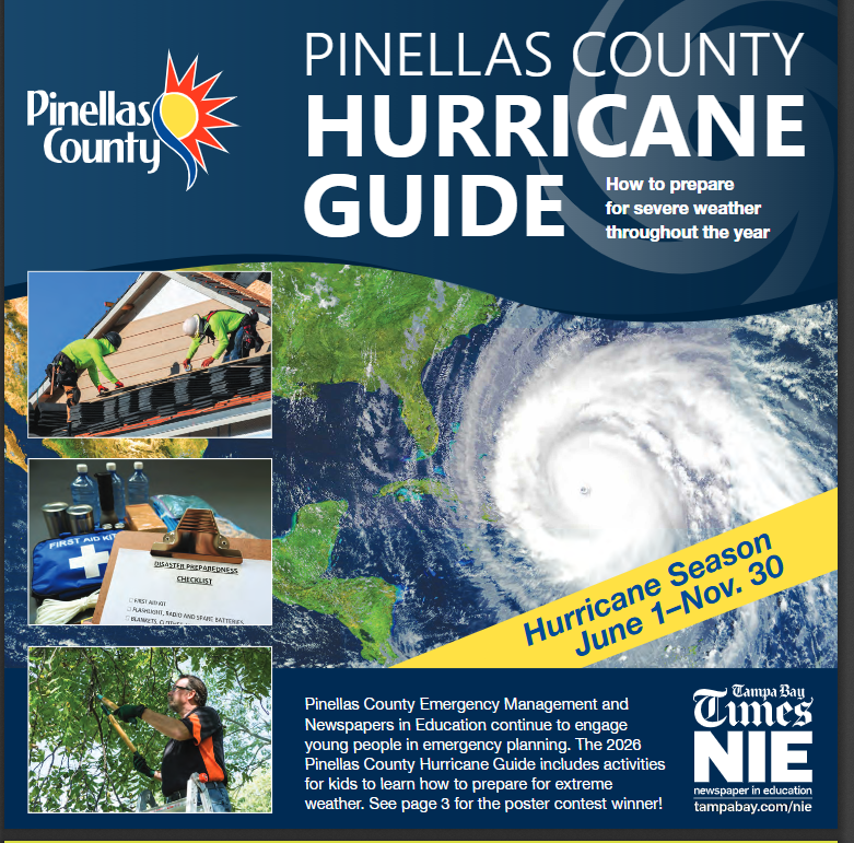
- Download the Hurricane Guide (PDF) in English, Spanish or Vietnamese.
Want to get involved?
Learn how you can help our community prepare for and respond to disasters.
Emergency Declarations & Orders
View all recent emergency declarations and executive orders
During emergencies, updates will also be posted on our Facebook, Instagram and X (@PinellasGov and @PinellasEM) feeds.