Linking Lealman Mobility Plan

Linking Lealman is a plan for improving how EVERYONE moves in Lealman: by car, bicycle, bus, mobility device or on foot. The purpose is to identify mobility and safety projects that can become part of the Pinellas County Capital Improvement Program (CIP).
The final Linking Lealman Plan is available for review. Find out more about the Plan by viewing the Linking Lealman video.
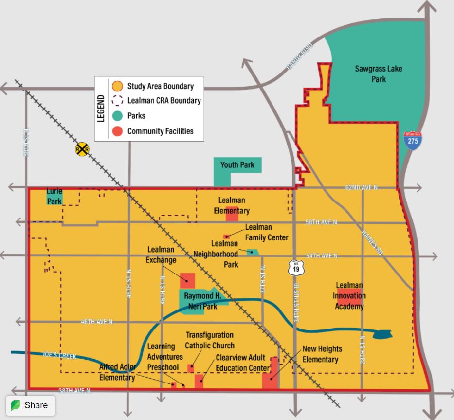
Study Area
The study area limits extend beyond the limits of the Lealman Community Redevelopment Area (CRA) to look at transportation in the area as a connected network, regardless of municipal boundaries.
Plan Goals
- Develop an action plan for future projects
- Identify safety improvements
- Establish a more complete street network
- Support redevelopment and economic opportunities
Get Involved / Community Outreach
Additional opportunities for community involvement will be provided as the plan is implemented.
The 54th Avenue North Complete Streets Concept Plan is available for review. Two alternative concepts are being carried forward for further development on the west segment and three concepts will be further developed for the east segment.
Email us your ideas, questions, and concerns about the study.
