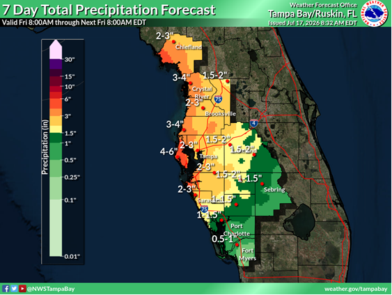
Rainfall, isolated flooding forecast for Pinellas County this weekend
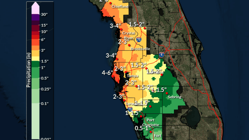
The National Weather Service is forecasting 6 to 8 inches of rainfall across Pinellas County over the next week, with majority of the heaviest rainfall occurring Sunday, July 19 through Tuesday, July 21.
Isolated flooding could occur, especially during periods of prolonged heavy rainfall and in low-lying areas. The National Hurricane Center is monitoring for the potential of tropical development, but the chances of a Tropical Depression forming are low (currently 20%). Monitor updates from the National Weather Service at weather.gov/tampa and the National Hurricane Center at hurricanes.gov.
Due to the possibility of heavy rain, be aware and prepared to take action, such as finding an alternate route. Drivers should be careful when approaching flooded roadways and intersections. Turn around, don’t drown! It only takes 6 inches of fast-moving water to sweep you off your feet, and one foot of water to carry away a car. Be careful when you’re out and about and avoid flooded areas.
If you have a lifted vehicle that will not be impacted by flooding, slow down and don’t speed. Waves from vehicles traveling on flooded roads cause more property damage than rising water alone. Remember, a state law passed in 2025 allows law enforcement to ticket drivers creating dangerous wakes when flood waters are present on roadways.
Do not play in flood waters, they are dangerous. Flood waters are contaminated with hazardous materials, aggressive wildlife and other obstructions that can cause serious illness or injuries.
Stay connected and informed. Sign up for Alert Pinellas to received free emergency notifications: disaster.pinellas.gov.
Report blocked ditches and storm drains at pinellas.gov/reportanissue.