Dunedin Causeway Bridges Project
Project ID
000423A
Project Location
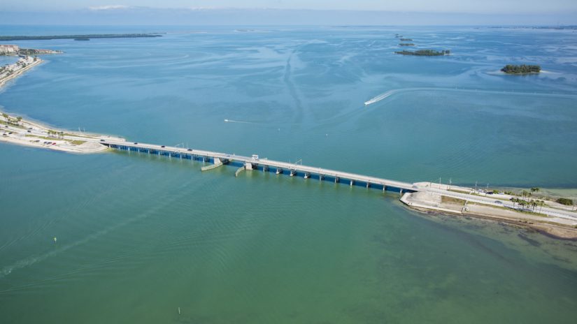
Dunedin Causeway Boulevard from Royal Stewart Arms Parkway on Honeymoon Island to the intersection of Gary Place/Gary Circle on Ward Island
Project Status
Design: On hold
Pinellas County received funding from the Federal Highway Administration through FDOT to repair the Dunedin Causeway due to damage caused by Hurricane Helene. Pinellas County’s work to restore the access road, conduct moveable bridge fender repairs, and repair both the tide relief bridge and movable bridge bag walls has been completed.
For any questions regarding launching motorized vessels from the Causeway, please contact the City of Dunedin at (727) 298-3000.
Project Overview
Pinellas County, in conjunction with FDOT, conducted a PD&E Study to evaluate options for rehabilitation or replacement of the Dunedin Causeway Bridges. The study extended along Dunedin Causeway Boulevard from Royal Stewart Arms Parkway on Honeymoon Island to the intersection of Gary Place/Gary Circle on Ward Island. The length of the project is about two miles. The study concluded that both bridges should be replaced.
The existing Main (bascule or movable) Bridge connects Ward Island to Dunedin Causeway. The existing Tide Relief Bridge is a fixed bridge that connects Dunedin Causeway to Honeymoon Island. The Main Bridge will be replaced with a new, two-lane mid-level movable bridge and the Tide Relief Bridge will be replaced with a new, two-lane low-level fixed bridge. There are no improvements planned for the Dunedin Causeway beaches or recreation areas. Minor roadway improvements will be needed to transition the existing roadway to the roadway on the replacement bridges. Temporary bridges will be constructed prior to demolition of the existing bridges to maintain traffic throughout construction.
Project Background
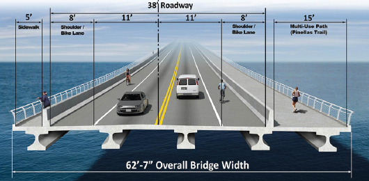
Both bridges were constructed in 1963 and are considered “functionally obsolete” because of their narrow width. There are no shoulders on the bridges, and the sidewalks on the north side are only 3½ feet wide. The multi-use path on the south side of the bridge is only six feet wide. Both the Main and Tide Relief bridges do not meet current engineering standards for resisting damage from high waves during significant storms and vessel impact.
Ongoing maintenance and repair of the Main (bascule) Bridge machinery also affects reliability and results in traffic delays. Major rehabilitation or replacement of both bridges is needed to keep the bridges open and the Main (bascule) Bridge operating efficiently.
The study provided many opportunities for community involvement. Input from the community and other stakeholders was an important factor in the selection of the best suitable alternative to ensure that it meets the transportation needs of the community, with all reasonable measures taken to minimize impacts to the social, cultural, physical and natural environment.
Proposed Typical Section (both bridges)
Anticipated Project Timeline
- Project Development and Environment (PD&E) Study: December 2014 – August 2020
- Design: To be determined
- Construction: To be determined
Project Funding
This project is supported by the Penny for Pinellas and future anticipated grants.
Contact Us
Rafal Kadaj, P.E. ENV-SP
Project Manager
Public Works / Capital Improvements
14 S. Fort Harrison Ave., Clearwater, FL 33756
(727) 464-8994
rkadaj@pinellas.gov