Pinellas County Projects
Pinellas County works to preserve and improve infrastructure, support our economy and meet the needs of the public. See major projects listed below. See projects on a map.
Beach and Coastal Projects
Construction: Completed
Emergency Beach Erosion Control Project
Multiple, see map
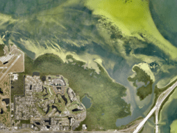
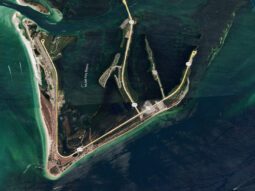
Grand Canal (Dents Channel) Dredging
Dents Channel in Tierra Verde
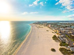
Pass-a-Grille Beach Nourishment
Pass-a-Grille Beach
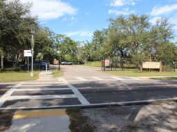
Madeira Beach Access Parking Area
14400 Gulf Blvd, Madeira Beach, FL 33708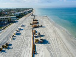
2025 Pinellas County Beach Nourishment Project
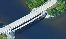
The island of Sand Key, Treasure Island and Upham Beach.Bridge Projects
Construction: Completed
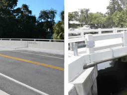
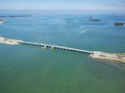
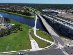
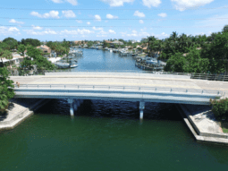
Westwinds and Crosswinds Bridges Project
Westwinds Drive over the Westwinds Canal and Crosswinds Drive over the Crosswinds Canal in Palm Harbor.
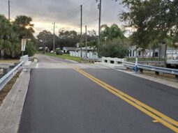
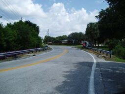
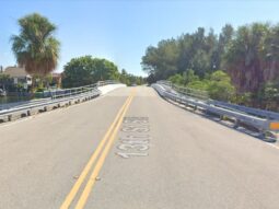
Old Coachman Road Bridge Replacement
Old Coachman Road, north of Sharkey Road
Construction: In progress
Oakwood Drive Bridge Replacement
Oakwood Drive over Stephanie's Channel in Harbor Bluffs subdivision
Construction: Not started
Design: Completed
Design: In progress
Beckett Bridge Replacement Project
Riverside Drive/N. Spring Boulevard over Whitcomb Bayou, Tarpon Springs
Ridgemoor Boulevard Bridge Replacement
Ridgemoor Boulevard in East Lake
Design: On hold
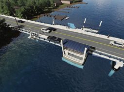
Dunedin Causeway Bridges Project
Dunedin Causeway Boulevard from Royal Stewart Arms Parkway on Honeymoon Island to the intersection of Gary Place/Gary Circle on Ward Island
Facility Construction
Construction: Completed
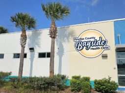
Bayside Health Clinic Expansion and Renovation Overview
14808 49th Street North Clearwater, FL 33762Construction: In progress
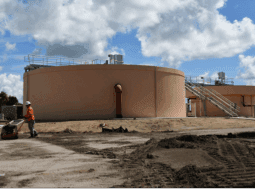
Industrial Water Treatment Facility Clarifier
2861 110th Avenue North St. PetersburgDesign: In progress
St. Pete-Clearwater Airport Terminal Improvement
14700 Terminal Blvd., Clearwater, FL 33762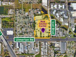
New Pinellas County Government Center
Ulmerton Road and Icot BlvdIntersection Improvements
Construction: In progress
Whitney Road and Wolford Road Intersection and Roadway Improvements
The intersection of Whitney Road and Wolford Road, and surrounding area.
Design: Not started
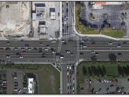
Belcher Road at Gulf to Bay Boulevard (S.R. 60) Intersection Improvement Study
Intersection of Belcher Road and Gulf to Bay Boulevard (S.R. 60) in Clearwater
Parks Projects
Construction: Completed
Sutherland Bayou Boat Ramp and Driveway Improvements
2119 US Highway 19 Alternate, Palm Harbor, FL 34683
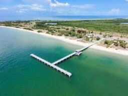
Fort De Soto Bay Pier Replacement
East side of Fort De Soto Park. Gulf Pier, on the west side of the park, remains open
Brooker Creek Preserve Boardwalk Rehabilitation
3940 Keystone Rd, Tarpon Springs, FL 34688
Sawgrass Lake Park Boardwalk & Tower Rehabilitation
7400 25th St. N., St. Petersburg, FL 33702
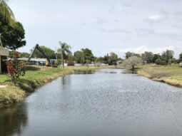
Taylor Lake Seawall Improvements
1100 8th Ave. SW, Largo, Florida 33770
Weedon Island Boardwalk and Pier Rehabilitation
Weedon Island Preserve
Construction: In progress
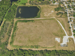
Rehabilitation of former disposal area on 119th Street N. (Future Greenspace)
12700 119th Street N., Largo, FL 33778Eagle Lake Park Rehabilitation
1800 Keene Road, Largo
War Veterans’ Memorial Park Boat Ramp
War Veterans' Memorial ParkDesign: In progress
Brooker Creek Preserve – Four Lakes Hammock Recreation Area
Brooker Creek Preserve
Wilde Lands Recreation Area
Brooker Creek Preserve
Roadway and Drainage Projects
Construction: Not started
Indian Rocks Road Improvements
Indian Rocks Road, Kent Drive to 8th Avenue SW
Design: In progress
Crystal Beach Drainage and Roadway Improvements
Crystal Beach Avenue to Florida Boulevard and St. Joseph's Sound to Avery Bayou
Study: Completed
Anclote Road Roadway and Stormwater Improvements (Anclote Blvd. to Alternate US 19)
Anclote Road from Anclote Blvd. to Alternate US 19
Roadway Improvements
Construction: Completed
22nd Avenue S. (51st Street to 34th Street) Roadway Improvements
22nd Avenue S. (51st Street to 34th Street)
Construction: In progress
Design: In progress
Riviere Road Roadway Improvements
Riviere Road between Tampa Road and Nebraska Avenue in Palm Harbor
Forest Lakes Blvd. Phase III Roadway Widening Improvements (SR 580 to SR 584/Tampa Road)
Forest Lakes Blvd. between SR 580 and SR 584/Tampa Road
West Bay Drive Improvements
West Bay Drive from Belleair Bridge in the City of Belleair Bluffs to the intersection of Clearwater-Largo Road in the City of Largo
Nebraska Avenue Roadway Improvements
Nebraska Avenue, between Alternate-19 and Westlake Boulevard in Palm Harbor
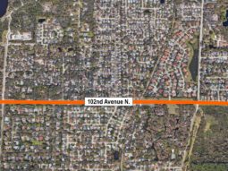
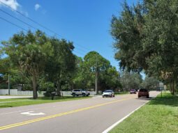
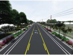
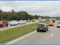
102nd Avenue N. Roadway Improvements
102nd Avenue, between 113th Street N. and 125th Street N., in unincorporated Seminole.
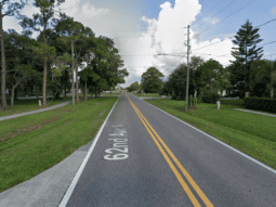
62nd Avenue N. Roadway Improvements (49th Street N. to 34th Street N.)
62nd Avenue N., between 49th Street N. and 34th Street N.
Design: Not started
Design: On hold
62nd Avenue N. Roadway Improvements (49th Street N. to 66th Street N.)
62nd Avenue N., between 49th Street N. and 66th Street N.
Study: Completed
62nd Avenue N. Roadway Improvements (49th Street N. to 66th Street N.)
62nd Avenue N., between 49th Street N. and 66th Street N.
Study: In progress
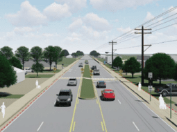
Whitney Road Complete Streets Project
Whitney Road from US 19 to Bolesta RoadSidewalk Projects
Construction: Completed
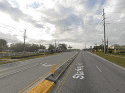
Starkey Road Sidewalk Improvements (Ulmerton Road to East Bay Drive)
Starkey Road between Ulmerton Road and East Bay Drive
Mehlenbacher Road Sidewalk Improvements
Mehlenbacher Road, on north side from Indian Rocks Road to the Pinellas Trail, and on the south side from Indian Rocks Road to west of Dolphin Drive, Belleair Bluffs
Construction: In progress
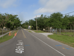
46th Avenue North Sidewalk Improvements (49th Street North to 37th Street North)
46th Avenue North in unincorporated Lealman from the intersection of 49th Street North to 37th Street North
Safe Routes To School
Multiple, see community-specific infoDesign: In progress
Highland Avenue Improvements
Highland Avenue, from East Bay Drive to Belleair Road
Stormwater and Drainage Projects
Construction: In progress
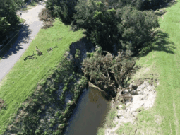
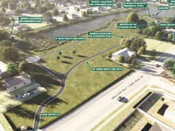
Roosevelt Creek Channel 5 Improvements
Roosevelt Creek Channel 5, north of Executive Drive/Old Roosevelt Boulevard and east of Evergreen Avenue in Clearwater
NRCS Emergency Debris Removal
Multiple, see mapDesign: In progress
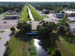
Joe’s Creek Restoration and Greenway Trail
Main Channel of Joe's Creek from 37th Street N. to 66th Street N.
Study: In progress
Flood Mitigation Action Plan
Multiple, see mapCherokee Drive Drainage Improvements
Cherokee Drive/48th Avenue N. area in unincorporated Seminole
Trail Projects
Construction: Completed
Pinellas Trail North Gap – Lake Tarpon Outfall Canal Bridge
Pinellas Trail, over the Lake Tarpon outfall canal
Construction: In progress
Pinellas Trail South Gap Phase I and Phase II
Pinellas Trail from 126th Avenue N. in Pinellas Park to Haines Bayshore Road in Largo
Design: In progress
Pinellas Trail South Gap Phase I and Phase II
Pinellas Trail from 126th Avenue N. in Pinellas Park to Haines Bayshore Road in Largo
McKay Creek Greenway Trail
McKay Creek area
Utilities
Construction: Completed
Grove Terrace & Oakdale Terrace Water Main Replacement and Relocation
Oakdale Terrace, Johnson Road, and Grove Terrace in Seminole53rd Avenue North Force Main Replacement
53rd Avenue N from Duhme Road to just east of Seminole Boulevard in unincorporated St. Petersburg.62nd Street North Force Main Replacement
62nd Street North from St. Joe's Creek to 44th Avenue North, and 44th Avenue North to just east of 61st Way North in Kenneth City.Construction: In progress
Manufactured Housing Communities Utility System Replacement
13 manufactured home communities: 11 west and north of Lake Seminole and two near U.S. 19 and 62nd Ave N.96th Place Sewer Main Replacement
96th Place from the Pinellas Trail to Ridge Road in Seminole, Florida.North Pinellas County Reclaimed Water Booster Pump Station
Community: Palm Harbor - Fox Chase area Project Site: Southwest corner of the intersection of County Road 70 and Belcher Road in unincorporated Palm Harbor. See project map for details.Oakhurst Shores Wastewater Pump Station Upgrade
Wastewater Pump Station 167 at the intersection of Oakhurst Dr. and Bayshore Dr.South Cross Bayou Advanced Water Reclamation Facility Denitrification Improvement Project
South Cross Bayou Advanced Water Reclamation Facility, 7401 54th Avenue N., St. Petersburg, FL 33709Construction: Not started
Pass-A-Grille Water Main Improvement
St. Pete Beach along Pass A Grille Way and Gulf Way from 9th Avenue to 22nd AvenueKernwood Court Wastewater Force Main Upgrade
PS415 FM Modification: Force Main modification from the intersection of Knobview way and Kernwood Ct roads near PS 415 along Kernwood Ct going west and then south (Kylemont and Lynnwood neighborhoods) until the cul-de-sac and then through the utility easement up to Lansbrook Pkwy Road. PS 323 FM Modification: Force Main modification near Alderman Road and PS 323Design: Completed
60-Inch Transmission Water Main Line Valve at Keller
The project is located near the Keller Water Treatment Plant (WTP) in Tarpon Springs, within unincorporated Pinellas County.Design: In progress
Lake Tarpon Septic-to-Sewer Conversion
Three communities northeast of Lake Tarpon.Gulf Beach Water Booster Station Improvements
The east side of Gulf Boulevard between 45th and 46th Avenues in St. Pete Beach54th Avenue North Road Force Main Replacement
54th Avenue North from the west bank of St. Joe's Creek to 74th Street North in St. Petersburg.Duhme Road Force Main Replacement
Duhme Road from American Legion Drive to 53rd Avenue NorthKlosterman Road Force Main Replacement
The intersection of Belcher and Klosterman roads to the William E. Dunn Water Reclamation Facility on U.S. Highway Alt. 19Pass-A-Grille to Tierra Verde Subaqueous Water Main Replacement
Intercoastal water way between Pass-a-Grille Beach at 9th Avenue & Pass-A-Grille Way, and Pine Key at 8th Avenue North & 6th Street West.Vina Del Mar Neighborhood Water Main Improvements
Located in the Vina Del Mar Island neighborhood of St. Pete Beach, Pinellas County.Kernwood Court Wastewater Force Main Upgrade
PS415 FM Modification: Force Main modification from the intersection of Knobview way and Kernwood Ct roads near PS 415 along Kernwood Ct going west and then south (Kylemont and Lynnwood neighborhoods) until the cul-de-sac and then through the utility easement up to Lansbrook Pkwy Road. PS 323 FM Modification: Force Main modification near Alderman Road and PS 323St. Pete Beach Submerged Water Main Upgrade
Located in the City of St. Pete Beach, and extends to Vina Del Mar Island Neighborhood, Pinellas CountyPinellas Park Wastewater Collection System Upgrade
Located in Pinellas Park, Pinellas County133rd Ave N to 126th Ave N Water Main Upgrade Project
133rd to 126th Ave N Neighborhood, Largo, Pinellas CountyRidgewood Estates Sewer Improvements
Ridgewood Estates at the east end of 82nd Avenue N and along 113th Street (near the intersection with 82nd Avenue N) in the City of SeminoleDesign: Not started
Madeira Beach to Treasure Island Submerged Water Main Upgrade
29th Ave E to Key Capri, Madeira Beach to Treasure IslandDesign: On hold
173rd to 176th Ave East Redington Neighborhood Water Main Replacement
The neighborhoods surrounding 173rd to 176th Avenues East in Redington Shores and North Redington Beach.Implementation: In Progress
Digital Meter Upgrade
Unincorporated Pinellas CountyStudy: In progress
Beach and Coastal Projects
Emergency Beach Erosion Control Project
Multiple, see map
Status: Construction: Completed
Grand Canal (Dents Channel) Dredging
Dents Channel in Tierra Verde
Status: Construction: Completed
Pass-a-Grille Beach Nourishment
Pass-a-Grille Beach
Status: Construction: Completed
Madeira Beach Access Parking Area
14400 Gulf Blvd, Madeira Beach, FL 33708
Status: Construction: Completed
2025 Pinellas County Beach Nourishment Project
The island of Sand Key, Treasure Island and Upham Beach.
Status: Construction: Completed
Bridge Projects
Beckett Bridge Replacement Project
Riverside Drive/N. Spring Boulevard over Whitcomb Bayou, Tarpon Springs
Status: Design: In progress
Dunedin Causeway Bridges Project
Dunedin Causeway Boulevard from Royal Stewart Arms Parkway on Honeymoon Island to the intersection of Gary Place/Gary Circle on Ward Island
Status: Design: On hold
San Martin Boulevard Bridge Replacement
Tallahassee Drive to Weedon Drive in St. Petersburg
Status: Design: In progress
Westwinds and Crosswinds Bridges Project
Westwinds Drive over the Westwinds Canal and Crosswinds Drive over the Crosswinds Canal in Palm Harbor.
Status: Construction: Completed
Oakwood Drive Bridge Replacement
Oakwood Drive over Stephanie's Channel in Harbor Bluffs subdivision
Status: Construction: In progress
13th Street/Sands Point Drive Bridge Replacement
13th Street S., near 3rd Avenue S. in Tierra Verde
Status: Construction: In progress
Madonna Boulevard Bridge Replacement
Madonna Boulevard in Tierra Verde
Status: Design: Completed, Construction: Not started
Old Coachman Road Bridge Replacement
Old Coachman Road, north of Sharkey Road
Status: Construction: Completed
Ridgemoor Boulevard Bridge Replacement
Ridgemoor Boulevard in East Lake
Status: Design: In progress
Facility Construction
Bayside Health Clinic Expansion and Renovation Overview
14808 49th Street North
Clearwater, FL 33762
Status: Construction: Completed
St. Pete-Clearwater Airport Terminal Improvement
14700 Terminal Blvd., Clearwater, FL 33762
Status: Design: In progress
Industrial Water Treatment Facility Clarifier
2861 110th Avenue North
St. Petersburg
Status: Construction: In progress
New Pinellas County Government Center
Ulmerton Road and Icot Blvd
Status: Design: In progress
Intersection Improvements
Belcher Road at Gulf to Bay Boulevard (S.R. 60) Intersection Improvement Study
Intersection of Belcher Road and Gulf to Bay Boulevard (S.R. 60) in Clearwater
Status: Design: Not started
Whitney Road and Wolford Road Intersection and Roadway Improvements
The intersection of Whitney Road and Wolford Road, and surrounding area.
Status: Construction: In progress
Parks Projects
Sutherland Bayou Boat Ramp and Driveway Improvements
2119 US Highway 19 Alternate, Palm Harbor, FL 34683
Status: Construction: Completed
Fort De Soto Bay Pier Replacement
East side of Fort De Soto Park. Gulf Pier, on the west side of the park, remains open
Status: Construction: Completed
Brooker Creek Preserve Boardwalk Rehabilitation
3940 Keystone Rd, Tarpon Springs, FL 34688
Status: Construction: Completed
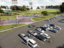
High Point Community Park
On the site of the former High Point Elementary School
Status: Construction: In progress
Dansville Community Park
Wilcox Road, between Jackson Street and Pine Street
Status: Construction: Completed
Sawgrass Lake Park Boardwalk & Tower Rehabilitation
7400 25th St. N., St. Petersburg, FL 33702
Status: Construction: Completed
Brooker Creek Preserve – Four Lakes Hammock Recreation Area
Brooker Creek Preserve
Status: Design: In progress
Weedon Island Preserve Salt Marsh Restoration
Weedon Island Preserve
Status: Construction: Completed
Wilde Lands Recreation Area
Brooker Creek Preserve
Status: Design: In progress
Taylor Lake Seawall Improvements
1100 8th Ave. SW,
Largo, Florida 33770
Status: Construction: Completed
Rehabilitation of former disposal area on 119th Street N. (Future Greenspace)
12700 119th Street N., Largo, FL 33778
Status: Construction: In progress
Weedon Island Boardwalk and Pier Rehabilitation
Weedon Island Preserve
Status: Construction: Completed
Eagle Lake Park Rehabilitation
1800 Keene Road, Largo
Status: Construction: Completed
War Veterans’ Memorial Park Boat Ramp
War Veterans' Memorial Park
Status: Construction: In progress
Roadway and Drainage Projects
Crystal Beach Drainage and Roadway Improvements
Crystal Beach Avenue to Florida Boulevard and St. Joseph's Sound to Avery Bayou
Status: Design: In progress
Anclote Road Roadway and Stormwater Improvements (Anclote Blvd. to Alternate US 19)
Anclote Road from Anclote Blvd. to Alternate US 19
Status: Study: Completed
Indian Rocks Road Improvements
Indian Rocks Road, Kent Drive to 8th Avenue SW
Status: Construction: In progress
Roadway Improvements
East Lake Road Corridor
East Lake Road from south of Curlew Road to north of Trinity Boulevard
Status: Study: In progress
Riviere Road Roadway Improvements
Riviere Road between Tampa Road and Nebraska Avenue in Palm Harbor
Status: Design: In progress
Forest Lakes Blvd. Phase III Roadway Widening Improvements (SR 580 to SR 584/Tampa Road)
Forest Lakes Blvd. between SR 580 and SR 584/Tampa Road
Status: Design: In progress
West Bay Drive Improvements
West Bay Drive from Belleair Bridge in the City of Belleair Bluffs to the intersection of Clearwater-Largo Road in the City of Largo
Status: Design: In progress
Nebraska Avenue Roadway Improvements
Nebraska Avenue, between Alternate-19 and Westlake Boulevard in Palm Harbor
Status: Design: In progress
71st Street North Roadway Improvements
71st Street N., between 38th Avenue N. and 54th Avenue N.
Status: Construction: In progress
102nd Avenue N. Roadway Improvements
102nd Avenue, between 113th Street N. and 125th Street N., in unincorporated Seminole.
Status: Design: In progress
Whitney Road Complete Streets Project
Whitney Road from US 19 to Bolesta Road
Status: Study: Completed
62nd Avenue N. Roadway Improvements (49th Street N. to 34th Street N.)
62nd Avenue N., between 49th Street N. and 34th Street N.
Status: Design: In progress
54th Avenue N. Improvements
54th Avenue N., from 49th Street N. to 34th Street N.
Status: Design: Not started, Study: Completed
62nd Avenue N. Roadway Improvements (49th Street N. to 66th Street N.)
62nd Avenue N., between 49th Street N. and 66th Street N.
Status: Study: Completed, Design: On hold
22nd Avenue S. (51st Street to 34th Street) Roadway Improvements
22nd Avenue S. (51st Street to 34th Street)
Status: Construction: Completed
Sidewalk Projects
46th Avenue North Sidewalk Improvements (49th Street North to 37th Street North)
46th Avenue North in unincorporated Lealman from the intersection of 49th Street North to 37th Street North
Status: Construction: In progress
Starkey Road Sidewalk Improvements (Ulmerton Road to East Bay Drive)
Starkey Road between Ulmerton Road and East Bay Drive
Status: Construction: Completed
Mehlenbacher Road Sidewalk Improvements
Mehlenbacher Road, on north side from Indian Rocks Road to the Pinellas Trail, and on the south side from Indian Rocks Road to west of Dolphin Drive, Belleair Bluffs
Status: Construction: Completed
Safe Routes To School
Multiple, see community-specific info
Status: Construction: In progress
Highland Avenue Improvements
Highland Avenue, from East Bay Drive to Belleair Road
Status: Design: In progress
Stormwater and Drainage Projects
Baypointe Stormwater Conservation Area
Seminole area formerly known as the Baypointe Golf Course
Status: Design: In progress
Joe’s Creek Restoration and Greenway Trail
Main Channel of Joe's Creek from 37th Street N. to 66th Street N.
Status: Design: In progress

Flood Vulnerability Assessment
Status: Study: In progress
Flood Mitigation Action Plan
Multiple, see map
Status: Study: In progress
Roosevelt Creek Channel 5 Improvements
Roosevelt Creek Channel 5, north of Executive Drive/Old Roosevelt Boulevard and east of Evergreen Avenue in Clearwater
Status: Construction: In progress
Cherokee Drive Drainage Improvements
Cherokee Drive/48th Avenue N. area in unincorporated Seminole
Status: Study: In progress
NRCS Emergency Debris Removal
Multiple, see map
Status: Construction: In progress
Trail Projects
Pinellas Trail North Gap – Lake Tarpon Outfall Canal Bridge
Pinellas Trail, over the Lake Tarpon outfall canal
Status: Construction: Completed
Pinellas Trail South Gap Phase I and Phase II
Pinellas Trail from 126th Avenue N. in Pinellas Park to Haines Bayshore Road in Largo
Status: Design: In progress, Construction: In progress
McKay Creek Greenway Trail
McKay Creek area
Status: Design: In progress
Utilities
Digital Meter Upgrade
Unincorporated Pinellas County
Status: Implementation: In Progress
Manufactured Housing Communities Utility System Replacement
13 manufactured home communities: 11 west and north of Lake Seminole and two near U.S. 19 and 62nd Ave N.
Status: Construction: In progress
Lake Tarpon Septic-to-Sewer Conversion
Three communities northeast of Lake Tarpon.
Status: Design: In progress
Pass-A-Grille Water Main Improvement
St. Pete Beach along Pass A Grille Way and Gulf Way from 9th Avenue to 22nd Avenue
Status: Construction: Not started
Gulf Beach Water Booster Station Improvements
The east side of Gulf Boulevard between 45th and 46th Avenues in St. Pete Beach
Status: Design: In progress
Grove Terrace & Oakdale Terrace Water Main Replacement and Relocation
Oakdale Terrace, Johnson Road, and Grove Terrace in Seminole
Status: Construction: Completed
53rd Avenue North Force Main Replacement
53rd Avenue N from Duhme Road to just east of Seminole Boulevard in unincorporated St. Petersburg.
Status: Construction: Completed
62nd Street North Force Main Replacement
62nd Street North from St. Joe's Creek to 44th Avenue North, and 44th Avenue North to just east of 61st Way North in Kenneth City.
Status: Construction: Completed
96th Place Sewer Main Replacement
96th Place from the Pinellas Trail to Ridge Road in Seminole, Florida.
Status: Construction: In progress
173rd to 176th Ave East Redington Neighborhood Water Main Replacement
The neighborhoods surrounding 173rd to 176th Avenues East in Redington Shores and North Redington Beach.
Status: Design: On hold
54th Avenue North Road Force Main Replacement
54th Avenue North from the west bank of St. Joe's Creek to 74th Street North in St. Petersburg.
Status: Design: In progress
Duhme Road Force Main Replacement
Duhme Road from American Legion Drive to 53rd Avenue North
Status: Design: In progress
Klosterman Road Force Main Replacement
The intersection of Belcher and Klosterman roads to the William E. Dunn Water Reclamation Facility on U.S. Highway Alt. 19
Status: Design: In progress
Pass-A-Grille to Tierra Verde Subaqueous Water Main Replacement
Intercoastal water way between Pass-a-Grille Beach at 9th Avenue & Pass-A-Grille Way, and Pine Key at 8th Avenue North & 6th Street West.
Status: Design: In progress
North Pinellas County Reclaimed Water Booster Pump Station
Community: Palm Harbor - Fox Chase area
Project Site: Southwest corner of the intersection of County Road 70 and Belcher Road in unincorporated Palm Harbor.
See project map for details.
Status: Construction: In progress
60-Inch Transmission Water Main Line Valve at Keller
The project is located near the Keller Water Treatment Plant (WTP) in Tarpon Springs, within unincorporated Pinellas County.
Status: Design: Completed
Vina Del Mar Neighborhood Water Main Improvements
Located in the Vina Del Mar Island neighborhood of St. Pete Beach, Pinellas County.
Status: Design: In progress
Kernwood Court Wastewater Force Main Upgrade
PS415 FM Modification: Force Main modification from the intersection of Knobview way and Kernwood Ct roads near PS 415 along Kernwood Ct going west and then south (Kylemont and Lynnwood neighborhoods) until the cul-de-sac and then through the utility easement up to Lansbrook Pkwy Road.
PS 323 FM Modification: Force Main modification near Alderman Road and PS 323
Status: Design: In progress, Construction: Not started
Madeira Beach to Treasure Island Submerged Water Main Upgrade
29th Ave E to Key Capri, Madeira Beach to Treasure Island
Status: Design: Not started
St. Pete Beach Submerged Water Main Upgrade
Located in the City of St. Pete Beach, and extends to Vina Del Mar Island Neighborhood, Pinellas County
Status: Design: In progress
Oakhurst Shores Wastewater Pump Station Upgrade
Wastewater Pump Station 167 at the intersection of Oakhurst Dr. and Bayshore Dr.
Status: Construction: In progress
Pinellas Park Wastewater Collection System Upgrade
Located in Pinellas Park, Pinellas County
Status: Design: In progress
133rd Ave N to 126th Ave N Water Main Upgrade Project
133rd to 126th Ave N Neighborhood, Largo, Pinellas County
Status: Design: In progress
Ridgewood Estates Sewer Improvements
Ridgewood Estates at the east end of 82nd Avenue N and along 113th Street (near the intersection with 82nd Avenue N) in the City of Seminole
Status: Design: In progress
South Cross Bayou Advanced Water Reclamation Facility Denitrification Improvement Project
South Cross Bayou Advanced Water Reclamation Facility, 7401 54th Avenue N., St. Petersburg, FL 33709
Status: Construction: In progress
Tampa Bay Estuary Program Septic-to-Sewer Project
Status: Study: In progress
102nd Avenue N. Roadway Improvements
102nd Avenue, between 113th Street N. and 125th Street N., in unincorporated Seminole.Status: Design: In progress
Type: Roadway Improvements
133rd Ave N to 126th Ave N Water Main Upgrade Project
133rd to 126th Ave N Neighborhood, Largo, Pinellas CountyStatus: Design: In progress
Type: Utilities
13th Street/Sands Point Drive Bridge Replacement
13th Street S., near 3rd Avenue S. in Tierra VerdeStatus: Construction: In progress
Type: Bridge Projects
173rd to 176th Ave East Redington Neighborhood Water Main Replacement
The neighborhoods surrounding 173rd to 176th Avenues East in Redington Shores and North Redington Beach.Status: Design: On hold
Type: Utilities
2025 Pinellas County Beach Nourishment Project
The island of Sand Key, Treasure Island and Upham Beach.Status: Construction: Completed
Type: Beach and Coastal Projects
22nd Avenue S. (51st Street to 34th Street) Roadway Improvements
22nd Avenue S. (51st Street to 34th Street)Status: Construction: Completed
Type: Roadway Improvements
46th Avenue North Sidewalk Improvements (49th Street North to 37th Street North)
46th Avenue North in unincorporated Lealman from the intersection of 49th Street North to 37th Street NorthStatus: Construction: In progress
Type: Sidewalk Projects
53rd Avenue North Force Main Replacement
53rd Avenue N from Duhme Road to just east of Seminole Boulevard in unincorporated St. Petersburg.Status: Construction: Completed
Type: Utilities
54th Avenue N. Improvements
54th Avenue N., from 49th Street N. to 34th Street N.Status: Design: Not started, Study: Completed
Type: Roadway Improvements
54th Avenue North Road Force Main Replacement
54th Avenue North from the west bank of St. Joe's Creek to 74th Street North in St. Petersburg.Status: Design: In progress
Type: Utilities
60-Inch Transmission Water Main Line Valve at Keller
The project is located near the Keller Water Treatment Plant (WTP) in Tarpon Springs, within unincorporated Pinellas County.Status: Design: Completed
Type: Utilities
62nd Avenue N. Roadway Improvements (49th Street N. to 34th Street N.)
62nd Avenue N., between 49th Street N. and 34th Street N.Status: Design: In progress
Type: Roadway Improvements
62nd Avenue N. Roadway Improvements (49th Street N. to 66th Street N.)
62nd Avenue N., between 49th Street N. and 66th Street N.Status: Study: Completed, Design: On hold
Type: Roadway Improvements
62nd Street North Force Main Replacement
62nd Street North from St. Joe's Creek to 44th Avenue North, and 44th Avenue North to just east of 61st Way North in Kenneth City.Status: Construction: Completed
Type: Utilities
71st Street North Roadway Improvements
71st Street N., between 38th Avenue N. and 54th Avenue N.Status: Construction: In progress
Type: Roadway Improvements
96th Place Sewer Main Replacement
96th Place from the Pinellas Trail to Ridge Road in Seminole, Florida.Status: Construction: In progress
Type: Utilities
Anclote Road Roadway and Stormwater Improvements (Anclote Blvd. to Alternate US 19)
Anclote Road from Anclote Blvd. to Alternate US 19Status: Study: Completed
Type: Roadway and Drainage Projects
Baypointe Stormwater Conservation Area
Seminole area formerly known as the Baypointe Golf CourseStatus: Design: In progress
Type: Stormwater and Drainage Projects
Bayside Health Clinic Expansion and Renovation Overview
14808 49th Street North Clearwater, FL 33762Status: Construction: Completed
Type: Facility Construction
Beckett Bridge Replacement Project
Riverside Drive/N. Spring Boulevard over Whitcomb Bayou, Tarpon SpringsStatus: Design: In progress
Type: Bridge Projects
Belcher Road at Gulf to Bay Boulevard (S.R. 60) Intersection Improvement Study
Intersection of Belcher Road and Gulf to Bay Boulevard (S.R. 60) in ClearwaterStatus: Design: Not started
Type: Intersection Improvements
Brooker Creek Preserve – Four Lakes Hammock Recreation Area
Brooker Creek PreserveStatus: Design: In progress
Type: Parks Projects
Brooker Creek Preserve Boardwalk Rehabilitation
3940 Keystone Rd, Tarpon Springs, FL 34688Status: Construction: Completed
Type: Parks Projects
Cherokee Drive Drainage Improvements
Cherokee Drive/48th Avenue N. area in unincorporated SeminoleStatus: Study: In progress
Type: Stormwater and Drainage Projects
Crystal Beach Drainage and Roadway Improvements
Crystal Beach Avenue to Florida Boulevard and St. Joseph's Sound to Avery BayouStatus: Design: In progress
Type: Roadway and Drainage Projects
Dansville Community Park
Wilcox Road, between Jackson Street and Pine StreetStatus: Construction: Completed
Type: Parks Projects
Digital Meter Upgrade
Unincorporated Pinellas CountyStatus: Implementation: In Progress
Type: Utilities
Duhme Road Force Main Replacement
Duhme Road from American Legion Drive to 53rd Avenue NorthStatus: Design: In progress
Type: Utilities
Dunedin Causeway Bridges Project
Dunedin Causeway Boulevard from Royal Stewart Arms Parkway on Honeymoon Island to the intersection of Gary Place/Gary Circle on Ward IslandStatus: Design: On hold
Type: Bridge Projects
Eagle Lake Park Rehabilitation
1800 Keene Road, LargoStatus: Construction: Completed
Type: Parks Projects
East Lake Road Corridor
East Lake Road from south of Curlew Road to north of Trinity BoulevardStatus: Study: In progress
Type: Roadway Improvements
Emergency Beach Erosion Control Project
Multiple, see mapStatus: Construction: Completed
Type: Beach and Coastal Projects
Flood Mitigation Action Plan
Multiple, see mapStatus: Study: In progress
Type: Stormwater and Drainage Projects
Forest Lakes Blvd. Phase III Roadway Widening Improvements (SR 580 to SR 584/Tampa Road)
Forest Lakes Blvd. between SR 580 and SR 584/Tampa RoadStatus: Design: In progress
Type: Roadway Improvements
Fort De Soto Bay Pier Replacement
East side of Fort De Soto Park. Gulf Pier, on the west side of the park, remains openStatus: Construction: Completed
Type: Parks Projects
Fort De Soto Park Repairs and Improvements
3500 Pinellas Bayway S.Status: Design: In progress
Type: Parks Projects
Fort De Soto Recycling Drop-Off Center Improvements
3500 Pinellas Bayway S., Tierra Verde, FL 33715Status: Construction: In progress
Grand Canal (Dents Channel) Dredging
Dents Channel in Tierra VerdeStatus: Construction: Completed
Type: Beach and Coastal Projects
Grove Terrace & Oakdale Terrace Water Main Replacement and Relocation
Oakdale Terrace, Johnson Road, and Grove Terrace in SeminoleStatus: Construction: Completed
Type: Utilities
Gulf Beach Water Booster Station Improvements
The east side of Gulf Boulevard between 45th and 46th Avenues in St. Pete BeachStatus: Design: In progress
Type: Utilities
High Point Community Park
On the site of the former High Point Elementary SchoolStatus: Construction: In progress
Type: Parks Projects
Highland Avenue Improvements
Highland Avenue, from East Bay Drive to Belleair RoadStatus: Design: In progress
Type: Sidewalk Projects
Indian Rocks Road Improvements
Indian Rocks Road, Kent Drive to 8th Avenue SWStatus: Construction: In progress
Type: Roadway and Drainage Projects
Industrial Water Treatment Facility Clarifier
2861 110th Avenue North St. PetersburgStatus: Construction: In progress
Type: Facility Construction
Joe’s Creek Restoration and Greenway Trail
Main Channel of Joe's Creek from 37th Street N. to 66th Street N.Status: Design: In progress
Type: Stormwater and Drainage Projects
Kernwood Court Wastewater Force Main Upgrade
PS415 FM Modification: Force Main modification from the intersection of Knobview way and Kernwood Ct roads near PS 415 along Kernwood Ct going west and then south (Kylemont and Lynnwood neighborhoods) until the cul-de-sac and then through the utility easement up to Lansbrook Pkwy Road. PS 323 FM Modification: Force Main modification near Alderman Road and PS 323Status: Design: In progress, Construction: Not started
Type: Utilities
Klosterman Road Force Main Replacement
The intersection of Belcher and Klosterman roads to the William E. Dunn Water Reclamation Facility on U.S. Highway Alt. 19Status: Design: In progress
Type: Utilities
Lake Tarpon Septic-to-Sewer Conversion
Three communities northeast of Lake Tarpon.Status: Design: In progress
Type: Utilities
Madeira Beach Access Parking Area
14400 Gulf Blvd, Madeira Beach, FL 33708Status: Construction: Completed
Type: Beach and Coastal Projects
Madeira Beach to Treasure Island Submerged Water Main Upgrade
29th Ave E to Key Capri, Madeira Beach to Treasure IslandStatus: Design: Not started
Type: Utilities
Madonna Boulevard Bridge Replacement
Madonna Boulevard in Tierra VerdeStatus: Design: Completed, Construction: Not started
Type: Bridge Projects
Manufactured Housing Communities Utility System Replacement
13 manufactured home communities: 11 west and north of Lake Seminole and two near U.S. 19 and 62nd Ave N.Status: Construction: In progress
Type: Utilities
Mehlenbacher Road Sidewalk Improvements
Mehlenbacher Road, on north side from Indian Rocks Road to the Pinellas Trail, and on the south side from Indian Rocks Road to west of Dolphin Drive, Belleair BluffsStatus: Construction: Completed
Type: Sidewalk Projects
Nebraska Avenue Roadway Improvements
Nebraska Avenue, between Alternate-19 and Westlake Boulevard in Palm HarborStatus: Design: In progress
Type: Roadway Improvements
New Pinellas County Government Center
Ulmerton Road and Icot BlvdStatus: Design: In progress
Type: Facility Construction
North Pinellas County Reclaimed Water Booster Pump Station
Community: Palm Harbor - Fox Chase area Project Site: Southwest corner of the intersection of County Road 70 and Belcher Road in unincorporated Palm Harbor. See project map for details.Status: Construction: In progress
Type: Utilities
NRCS Emergency Debris Removal
Multiple, see mapStatus: Construction: In progress
Type: Stormwater and Drainage Projects
Oakhurst Shores Wastewater Pump Station Upgrade
Wastewater Pump Station 167 at the intersection of Oakhurst Dr. and Bayshore Dr.Status: Construction: In progress
Type: Utilities
Oakwood Drive Bridge Replacement
Oakwood Drive over Stephanie's Channel in Harbor Bluffs subdivisionStatus: Construction: In progress
Type: Bridge Projects
Old Coachman Road Bridge Replacement
Old Coachman Road, north of Sharkey RoadStatus: Construction: Completed
Type: Bridge Projects
Pass-a-Grille Beach Nourishment
Pass-a-Grille BeachStatus: Construction: Completed
Type: Beach and Coastal Projects
Pass-A-Grille to Tierra Verde Subaqueous Water Main Replacement
Intercoastal water way between Pass-a-Grille Beach at 9th Avenue & Pass-A-Grille Way, and Pine Key at 8th Avenue North & 6th Street West.Status: Design: In progress
Type: Utilities
Pass-A-Grille Water Main Improvement
St. Pete Beach along Pass A Grille Way and Gulf Way from 9th Avenue to 22nd AvenueStatus: Construction: Not started
Type: Utilities
Philippe Park Improvements
2525 Philippe Parkway, Safety HarborStatus: Design: In progress
Type: Parks Projects
Pinellas Park Wastewater Collection System Upgrade
Located in Pinellas Park, Pinellas CountyStatus: Design: In progress
Type: Utilities
Pinellas Trail North Gap – Lake Tarpon Outfall Canal Bridge
Pinellas Trail, over the Lake Tarpon outfall canalStatus: Construction: Completed
Type: Trail Projects
Pinellas Trail South Gap Phase I and Phase II
Pinellas Trail from 126th Avenue N. in Pinellas Park to Haines Bayshore Road in LargoStatus: Design: In progress, Construction: In progress
Type: Trail Projects
Rehabilitation of former disposal area on 119th Street N. (Future Greenspace)
12700 119th Street N., Largo, FL 33778Status: Construction: In progress
Type: Parks Projects
Ridgemoor Boulevard Bridge Replacement
Ridgemoor Boulevard in East LakeStatus: Design: In progress
Type: Bridge Projects
Ridgewood Estates Sewer Improvements
Ridgewood Estates at the east end of 82nd Avenue N and along 113th Street (near the intersection with 82nd Avenue N) in the City of SeminoleStatus: Design: In progress
Type: Utilities
Riviere Road Roadway Improvements
Riviere Road between Tampa Road and Nebraska Avenue in Palm HarborStatus: Design: In progress
Type: Roadway Improvements
Roosevelt Creek Channel 5 Improvements
Roosevelt Creek Channel 5, north of Executive Drive/Old Roosevelt Boulevard and east of Evergreen Avenue in ClearwaterStatus: Construction: In progress
Type: Stormwater and Drainage Projects
Safe Routes To School
Multiple, see community-specific infoStatus: Construction: In progress
Type: Sidewalk Projects
San Martin Boulevard Bridge Replacement
Tallahassee Drive to Weedon Drive in St. PetersburgStatus: Design: In progress
Type: Bridge Projects
Sawgrass Lake Park Boardwalk & Tower Rehabilitation
7400 25th St. N., St. Petersburg, FL 33702Status: Construction: Completed
Type: Parks Projects
Shore Drive Bridge Replacement
Shore Drive in Ozona/Palm HarborStatus: Design: In progress
Type: Bridge Projects
South Cross Bayou Advanced Water Reclamation Facility Denitrification Improvement Project
South Cross Bayou Advanced Water Reclamation Facility, 7401 54th Avenue N., St. Petersburg, FL 33709Status: Construction: In progress
Type: Utilities
St. Pete Beach Submerged Water Main Upgrade
Located in the City of St. Pete Beach, and extends to Vina Del Mar Island Neighborhood, Pinellas CountyStatus: Design: In progress
Type: Utilities
St. Pete-Clearwater Airport Terminal Improvement
14700 Terminal Blvd., Clearwater, FL 33762Status: Design: In progress
Type: Facility Construction
Starkey Road Sidewalk Improvements (Ulmerton Road to East Bay Drive)
Starkey Road between Ulmerton Road and East Bay DriveStatus: Construction: Completed
Type: Sidewalk Projects
Sutherland Bayou Boat Ramp and Driveway Improvements
2119 US Highway 19 Alternate, Palm Harbor, FL 34683Status: Construction: Completed
Type: Parks Projects
Taylor Lake Seawall Improvements
1100 8th Ave. SW, Largo, Florida 33770Status: Construction: Completed
Type: Parks Projects
Vina Del Mar Neighborhood Water Main Improvements
Located in the Vina Del Mar Island neighborhood of St. Pete Beach, Pinellas County.Status: Design: In progress
Type: Utilities
War Veterans’ Memorial Park Boat Ramp
War Veterans' Memorial ParkStatus: Construction: In progress
Type: Parks Projects
Weedon Island Boardwalk and Pier Rehabilitation
Weedon Island PreserveStatus: Construction: Completed
Type: Parks Projects
Weedon Island Preserve Salt Marsh Restoration
Weedon Island PreserveStatus: Construction: Completed
Type: Parks Projects
West Bay Drive Improvements
West Bay Drive from Belleair Bridge in the City of Belleair Bluffs to the intersection of Clearwater-Largo Road in the City of LargoStatus: Design: In progress
Type: Roadway Improvements
Westwinds and Crosswinds Bridges Project
Westwinds Drive over the Westwinds Canal and Crosswinds Drive over the Crosswinds Canal in Palm Harbor.Status: Construction: Completed
Type: Bridge Projects
Whitney Road and Wolford Road Intersection and Roadway Improvements
The intersection of Whitney Road and Wolford Road, and surrounding area.Status: Construction: In progress
Type: Intersection Improvements
Whitney Road Complete Streets Project
Whitney Road from US 19 to Bolesta RoadStatus: Study: Completed
Type: Roadway Improvements